
Remote sensing
Regional-scale observation for a better understanding of the terrain. PROGREM uses satellite and aerial imagery to reveal structures, alteration and spectral signatures relevant to geoscience studies.
Observation and interpretation
From raw imagery to actionable geoscientific insight
Remote sensing allows large areas to be examined using satellite or aerial data, from which information is extracted to support geological analysis and guide field investigations.
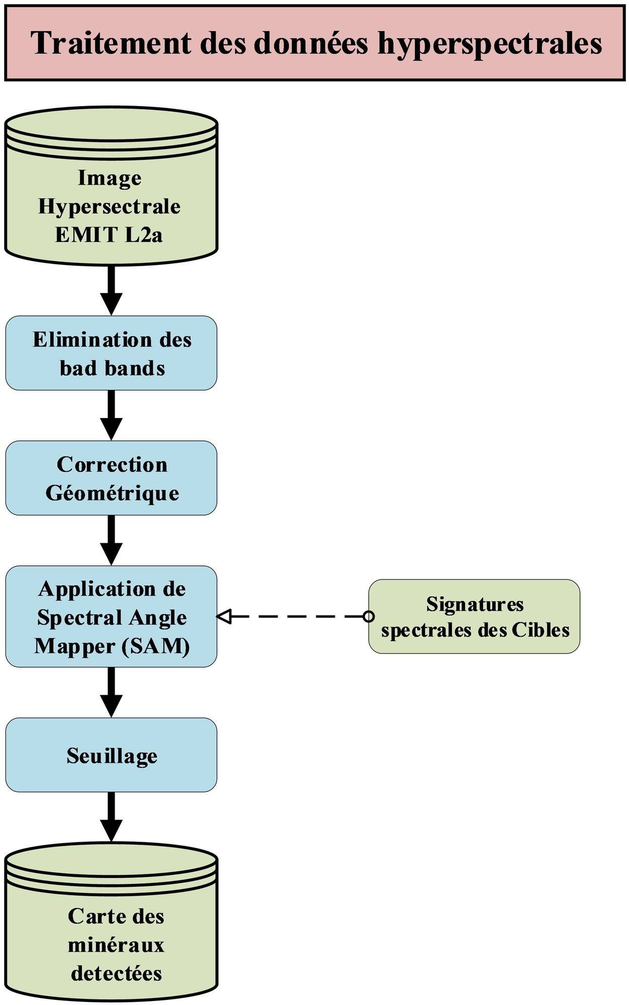
Multispectral and hyperspectral imagery
Processing of satellite data to identify mineral alteration and geological structures.
Structural analysis
Lineament analysis: detection of fractures and faults from satellite imagery to improve understanding of the regional geology.
Hydrothermal alteration
Identification of zones altered by hydrothermal fluids, which are often associated with mineral deposits.
Advanced photo-interpretation
Visual analysis of aerial and satellite imagery to complement geological studies.
An area to analyse by remote sensing?
Tell us about your study area and objectives: our team will propose an approach suited to the available data.